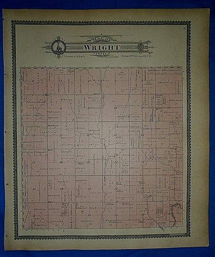
Vintage 1902 Plat Map ~ WRIGHT Twp. POTTAWATTAMIE Co. IOWA ~ Ancestry Genealogy
US $28.00US $28.00
Tue, Apr 29, 12:44 PMTue, Apr 29, 12:44 PM


Vintage 1902 Plat Map ~ WRIGHT Twp. POTTAWATTAMIE Co. IOWA ~ Ancestry Genealogy
US $28.00
Ends in
Condition:
“Always Quick N Free S&H ~ Browse through over 5000 Rare, Authentic, Antique & Collectible Maps in ”... Read moreabout condition
Ended: Apr 29, 2025 12:44:00 PDT
Oops! Looks like we're having trouble connecting to our server.
Refresh your browser window to try again.
Shipping:
Free USPS Ground Advantage®.
Located in: Old Orchard Beach, Maine, United States
Delivery:
Estimated between Fri, Jun 6 and Thu, Jun 12 to 94104
Returns:
30 days returns. Buyer pays for return shipping. If you use an eBay shipping label, it will be deducted from your refund amount.
Payments:
Special financing available. See terms and apply now- for PayPal Credit, opens in a new window or tab
Earn up to 5x points when you use your eBay Mastercard®. Learn moreabout earning points with eBay Mastercard
Shop with confidence
Seller assumes all responsibility for this listing.
eBay item number:405790900041
Item specifics
- Seller Notes
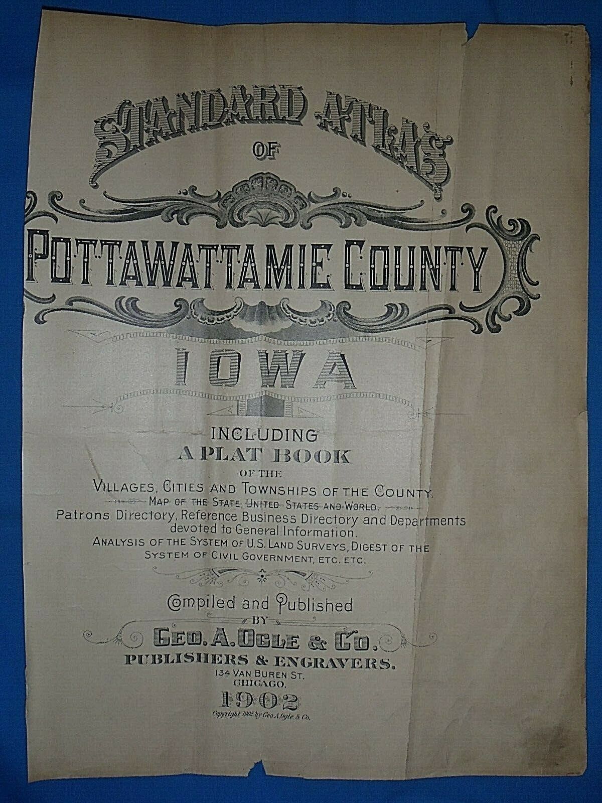
- Cartographer/Publisher
- Geo. A Ogle & Co.
- Original/Reproduction
- Vintage Original
- Format
- Atlas Map
- REF
- REF#IOWA1902/123020
- Type
- County Map
- Year
- 1902
- US State
- AR, IA, KS, LA, MO, NE, Iowa
- Date Range
- 1900-1909
- Country/Region
- United States of America
Item description from the seller
Seller Feedback
No feedback yet
More to explore :
- Iowa Rand McNally & Co. Antique North America Maps & Atlases,
- Vintage Reproduction Iowa Antique North America County Maps,
- Iowa Vintage Original Antique North American Maps & Atlases,
- Vintage Reproduction Antique North American Maps & Atlases Iowa,
- Antique North American Maps & Atlases Iowa,
- Iowa Antique North America Folding Maps,
- Iowa Antique North America Geological Maps,
- Iowa Antique North America Wall Maps,
- Chicago Iowa Antique North American Maps & Atlases,
- Iowa Lithography Antique North America Folding Maps