Picture 1 of 2
Stock photo


Picture 1 of 2
Stock photo


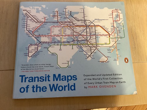
Transit Maps of the World : Expanded and Updated Edition of the World's First Collection of Every Urban Train Map on Earth by Mark Ovenden (2015, Trade Paperback)

idealandco (233)
100% positive feedback
Price:
$24.99
Free shipping
Returns:
Condition:
Brand new and in plastic wrap. The plastic wrap is not sealed on the bottom of the book.
- Buy It NowTransit Maps of the World : Expanded and Updated Edition of the World's First...
Oops! Looks like we're having trouble connecting to our server.
Refresh your browser window to try again.
About this product
Product Identifiers
PublisherPenguin Publishing Group
ISBN-100143128493
ISBN-139780143128496
eBay Product ID (ePID)208765263
Product Key Features
Book TitleTransit Maps of the World : Expanded and Updated Edition of the World's First Collection of Every Urban Train Map on Earth
Number of Pages176 Pages
LanguageEnglish
TopicRailroads / General, Railroads / History, Maps & Road Atlases (See Also Reference / Atlases, Gazetteers & Maps), Public Transportation, Industrial Design / General
Publication Year2015
FeaturesRevised
IllustratorYes
GenreTravel, Transportation, Technology & Engineering
AuthorMark Ovenden
FormatTrade Paperback
Dimensions
Item Height0.4 in
Item Weight23.8 Oz
Item Length9.3 in
Item Width10.9 in
Additional Product Features
Intended AudienceTrade
Reviews"Ovenden does what no other design history book has ever done. Transit Maps of the World is a must-have." - The New York Times Book Review "Fantastic." - LA Times "The perfect book." - USA Today "Pure catnip." -William Grimes, The New York Times "This book is the stuff that dreams are made of." - Newsday "A fabulous collection. These maps are almost works of art, and can kindle a remembrance of a past trip or a dream of a future journey." - Seattle Times "Impossibly nerdy and thoroughly compelling." - Kansas City Star "This is the kind of book that would be incredibly fun to browse with kids as part of a world geography investigation--and also the sort of thing that makes great bedtime reading if you want to salt your dreams with the possibility of travel to distant cities. Sheer public transit/map porn!" - Boingboing.com "Fascinating!" -Peter Greenberg, National Public Radio "Even if you are not a "map person" this book makes it so easy to experience the unique perspective of rail-based transit. Artistically a treat with its interesting colors, shapes and design; it's a coffee table essential. Ovenden brings a unique perspective to maps and to travel in general. Transit Maps of the World is a must-read for the literary traveller." - Literary Traveller.com "A vibrant tip of the hat to the world's urban train systems." - National Geographic Intelligent Traveller "[L]ook no further for the next must-have book." - Very Short List "The sort of book you couldn't imagine you needed until you got it and now you can't imagine how you could do without it . . . It's fantastic!" -Robert Elms, BBC London "Like a Conde Nast Traveler magazine for jetsetters with subterranean tendencies." - Metro "Delightful." - The Guardian , London "A beautifully illustrated study of the plans that help passengers navigate the world's metropolitan railway systems." - The Times , London "An object lesson in information design." - Wallpaper
Dewey Edition22
Grade FromTwelfth Grade
Dewey Decimal388.4280223
Edition DescriptionRevised edition
SynopsisA completely updated and expanded edition of the cult bestseller, featuring subway, light rail, and streetcar maps from New York to Nizhny Novgorod. Transit Maps of the World is the first and only comprehensive collection of historical and current maps of every rapid-transit system on earth. In glorious, colorful graphics, Mark Ovenden traces the cartographic history of mass transit--including rare and historic maps, diagrams, and photographs, some available for the first time since their original publication. Now expanded with thirty-six more pages, 250 city maps revised from previous editions, and listings given from almost a thousand systems in total, this is the graphic designer's new bible, the transport enthusiast's dream collection, and a coffee-table essential for everyone who's ever traveled in a city., A completely updated and expanded edition of the cult bestseller, a great holiday gift, featuring subway, light rail, and streetcar maps from New York to Nizhny Novgorod Transit Maps of the World is the first and only comprehensive collection of historical and current maps of every rapid-transit system on earth. In glorious, colorful graphics, Mark Ovenden traces the cartographic history of mass transit--including rare and historic maps, diagrams, and photographs, some available for the first time since their original publication. Now expanded with thirty-six more pages, 250 city maps revised from previous editions, and listings given from almost a thousand systems in total, this is the graphic designer's new bible, the transport enthusiast's dream collection, and a coffee-table essential for everyone who's ever traveled in a city.
All listings for this product


Ratings and Reviews
Most relevant reviews
- Feb 06, 2019
Fascinating book with almost microscopic font. Difficult to read the station names and other text on these maps
Verified purchase: YesCondition: New
- Dec 14, 2022
The book is excellent overall I found this book at a bookstore in Vernon Hills back in January of February in 2016.
It is a great book overall it has a lots of rail maps in the book and a few Chinese transit maps in the book it is a excellent book then the previous Vernon of this book. That book was published in 2007.
Verified purchase: YesCondition: Pre-owned
- Jan 06, 2016
Incredible detail in full color. Anything you ever wanted to know about transit maps in one place.
Verified purchase: YesCondition: New